
Home |
WATEX™ Solutions | WATEX™ Groundwater Mapping |
THE WATEX™ SYSTEM FOR GROUNDWATER EXPLORATION AND IRRIGATED AGRICULTURE IN NIGER (2019-2021)
Back
WATEX™ Groundwater Mapping
THE WATEX™ SYSTEM FOR GROUNDWATER EXPLORATION AND IRRIGATED AGRICULTURE IN NIGER (2019-2021)
The WATEX™ System is a groundbreaking technology to support and facilitate the development of both agriculture and industry of any nation.
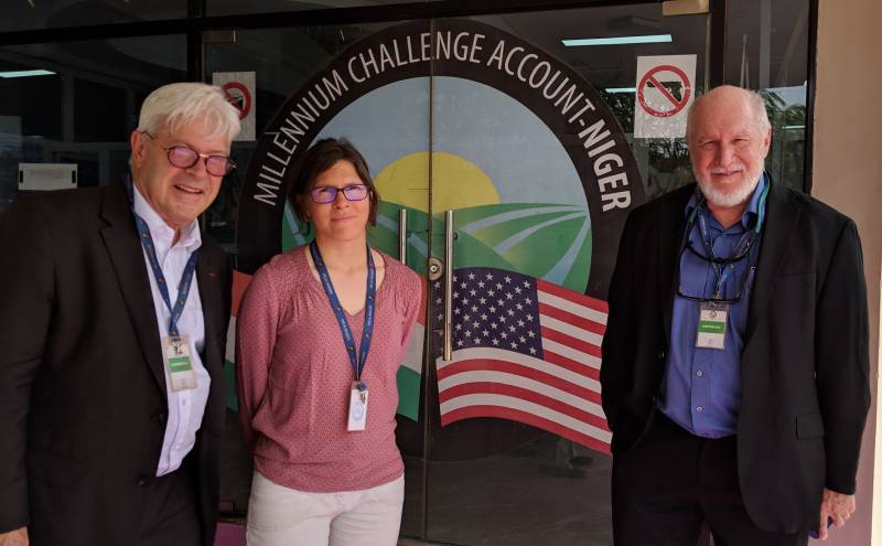
CONTEXTThe US State Department, through Millennium Challenge Corporation (“MCC”) increased the Government of Niger’s governance capacity with specific emphasis on water access management by co-creating MCA-Niger (“MCA”).
RTI won the tender in 2019 to launch the WATEX™ Groundwater Mapping program over the most populated area of south Niger, covering 260,000 km². This project focused on groundwater exploration to identify and assess key aquifers for sustainable water supply.
RTI won the tender in 2019 to launch the WATEX™ Groundwater Mapping program over the most populated area of south Niger, covering 260,000 km². This project focused on groundwater exploration to identify and assess key aquifers for sustainable water supply.
MCA implemented the following two projects:
- The Irrigation and Market Access Project aimed at increasing growth through improved agriculture, irrigation modernization and flood management systems, ensuring sufficient access to various existing sectors and markets.
- The Climate Resilient Communities Project whose objective is to increase the well-being of agriculture and livestock farming dependent families in eligible communes and in livestock breeding routes within the rural areas of Niger, by improving the access to water of farms and pastoralists.
EXCEPTIONAL HYDROGEOLOGICAL RESULTS
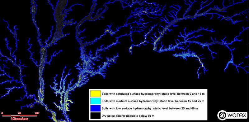
Niger appears to be one of the most groundwater-rich countries of the Sahel region, with basins deeper than expected, storing several giant aquifers with minimal available reserves of 650 billion m3.
The giant agricultural alluvial potential of Dallols Bosso, Maouri and Fogha:
Alluvial aquifers of Niger offer nearly 2 million hectares of arable soil for irrigated agriculture.
The Dallols have by themselves a cumulative groundwater volume of more than 50 billion m3 in the study area.
The exceptional character of the Dallols is reinforced by a free alluvial water table, accessible at shallow depth, with an annual recharge of 300 million m3, ensuring strong seasonal resilience to climate change.
Such results offer multiple opportunities to develop a wide range of irrigated agricultural projects on alluvial soils:
Such results offer multiple opportunities to develop a wide range of irrigated agricultural projects on alluvial soils:
- Small scale agricultural projects can be developed with easy access to shallow groundwater for irrigation.
- Large scale irrigated agricultural projects can tap into deeper aquifers.
As a result of this WATEX™ survey, Niger, one of the most threatened countries of the world impacted by climate change and with some of the hardest border conflicts, appears to be one of the wealthiest Sahel’s countries in groundwater resources to sustain an ambitious agricultural program, ensuring food and water security as well as peace for years to come.
➤ Contact us to learn more about our WATEX™ Groundwater Mapping projects.
Contact Us
