
Home |
WATEX™ Solutions | WATEX™ Groundwater Mapping |
THE WATEX™ SYSTEM, A GROUNDBREAKING TECHNOLOGY FOR INTERNATIONAL AGENCIES TO FIND WATER FOR DARFUR REFUGEES IN CHAD (2005-2008)
Back
WATEX™ Groundwater Mapping
THE WATEX™ SYSTEM, A GROUNDBREAKING TECHNOLOGY FOR INTERNATIONAL AGENCIES TO FIND WATER FOR DARFUR REFUGEES IN CHAD (2005-2008)
CONTEXT
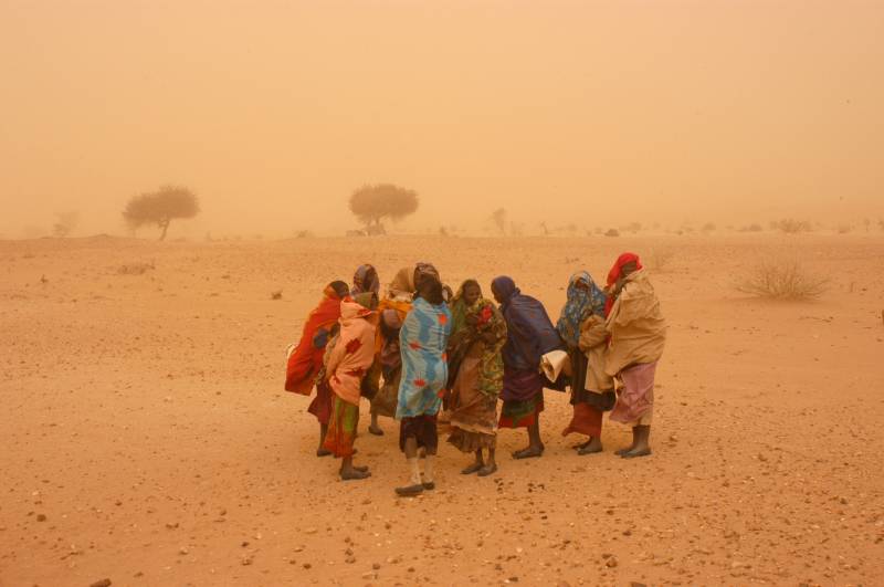
In March 2004, the international agency UNHCR requested that RTI address the problem of water supply crisis and conduct groundwater exploration to locate reserves capable of prociding water for 250,000 refugees in eastern Ouaddai, Chad, using the WATEX™ System.
Given the high number of human lives at risk, an immediate solution was imperative as each day without sufficient water supply resulted in the loss of 200 children's lives.
Part of the study was done on the field, navigating by GPS on the WATEX™ Groundwater Map synchronized with RTI's GIS database to reach the appropriate water targets and mark new drilling holes.
RESULTS FROM THE WATEX™ SYSTEM
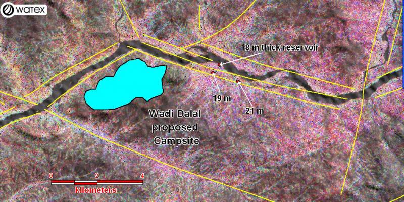
The Wadi Dalal refugee camp of Gaga is about 60 km east of Abéché, and was recommend by RTI because of its exceptional combination of a thick alluvial aquifer structured by open fractures, leading to high and sustainable yields with vertical annual recharge.
Optimized thanks to the WATEX™ groundwater study, drilling confirmed that the thick, high-quality gravel reservoir was fed by a large volume of water. In February 2005, UNHCR’s drilling partners (OXFAM) confirmed RTI’s prediction with 3 successful exploration wells drilled in March 2005.
Based upon the actual well productivity, the UNHCR announced in May 2005 its plans to resettle up to 30,000 refugees to the new Dalal Refugee Camp.
Based upon the actual well productivity, the UNHCR announced in May 2005 its plans to resettle up to 30,000 refugees to the new Dalal Refugee Camp.
IMPACT OF THE GROUNDWATER EXPLORATION STUDY
RTI significantly reduced the risks, cost and delays of groundwater exploration and limited field work to specific recorded targets with high groundwater potential.
Detection in less than 4 months of large renewable aquifers was capable of aiding up to 250,000 Sudanese refugees.
PRESS COMMENTS
UNHCR spokesperson, Jennifer Pagonis:
New technology shows promising results in search for water.
“Significant quantities of water have been discovered each time wells or boreholes were dug in areas suggested by the survey. The images have helped target sites for new wells and boreholes in three existing camps - Oure Cassoni, Touloum and Iridimi - and work is underway to dig for water at these points. The survey has also helped identify potential sites for new camps and rule out others due to lack of water potential. This study also paves the way towards sustainable water management in the region.” UNHCR.ORG
Geoff Worldley, a senior UN emergency officer:
“Based on RTI’s data, the UN has saved months of running around and drilling tests wells. Without Gachet’s data, we might as well be using divining rods.”
To learn more about our WATEX™ Groundwater Mapping projects, please contact us !
Contact Us
