
Home |
WATEX™ Solutions | WATEX™ Fire Prevention & Ecoforestry Mapping |
THE WATEX™ SYSTEM, A UNIQUE SOLUTION FOR ECOFORESTRY IN CHILE (2017)
Back
WATEX™ Fire Prevention & Ecoforestry Mapping
THE WATEX™ SYSTEM, A UNIQUE SOLUTION FOR ECOFORESTRY IN CHILE (2017)
In regions prone to wildfires, the WATEX™ System is a key tool to prevent those fires and promote reforestation.
CONTEXT
As a consequence of climate change and confronted by extremely high temperatures in January 2017, Chile faced 124 mega-fires of unprecedented violence, which devastated 366,520 ha in a few days.
Apart from the ecological disaster for the fauna and flora, 11 people were killed, 30 injured, 1,100 evacuated and 1,047 houses were damaged.
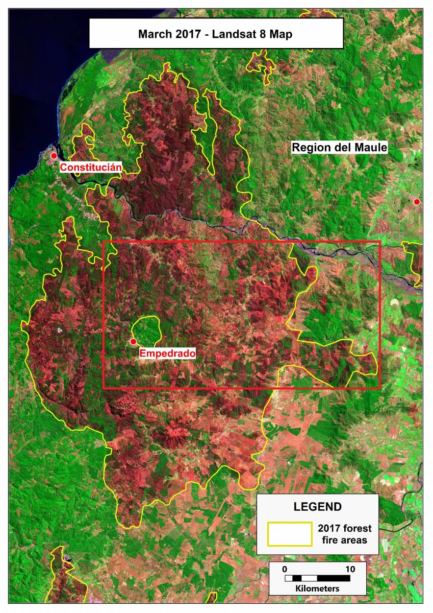
In the Maule region near Empredado, the WATEX™ imagery scanned after the fires will indicate the most favorable areas to start reforestation, optimizing the size of the investment, as was the case in Chile after January 2017.

REFORESTATION GUIDANCE MAPPING THROUGH THE WATEX™ SYSTEM
These areas correspond to the best locations where underground soils hydromorphy remains the highest (blue areas) after the fires.
Within the yellow dotted polygons, the replanted trees have a strong chance to unite with the moist underground zone in order to feed and hydrate roots after a short seasonal irrigation support.
Contact us to learn more about our WATEX™ fire prevention & Ecoforestry mapping solution.
Contact Us
