
THE WATEX™ SYSTEM, A SOLUTION TO FIND WATER FOR KAKUMA REFUGEE CAMP IN KENYA (2012)
The WATEX™ System is a key technology to help international institutions finding water for refugee camps.
CONTEXT
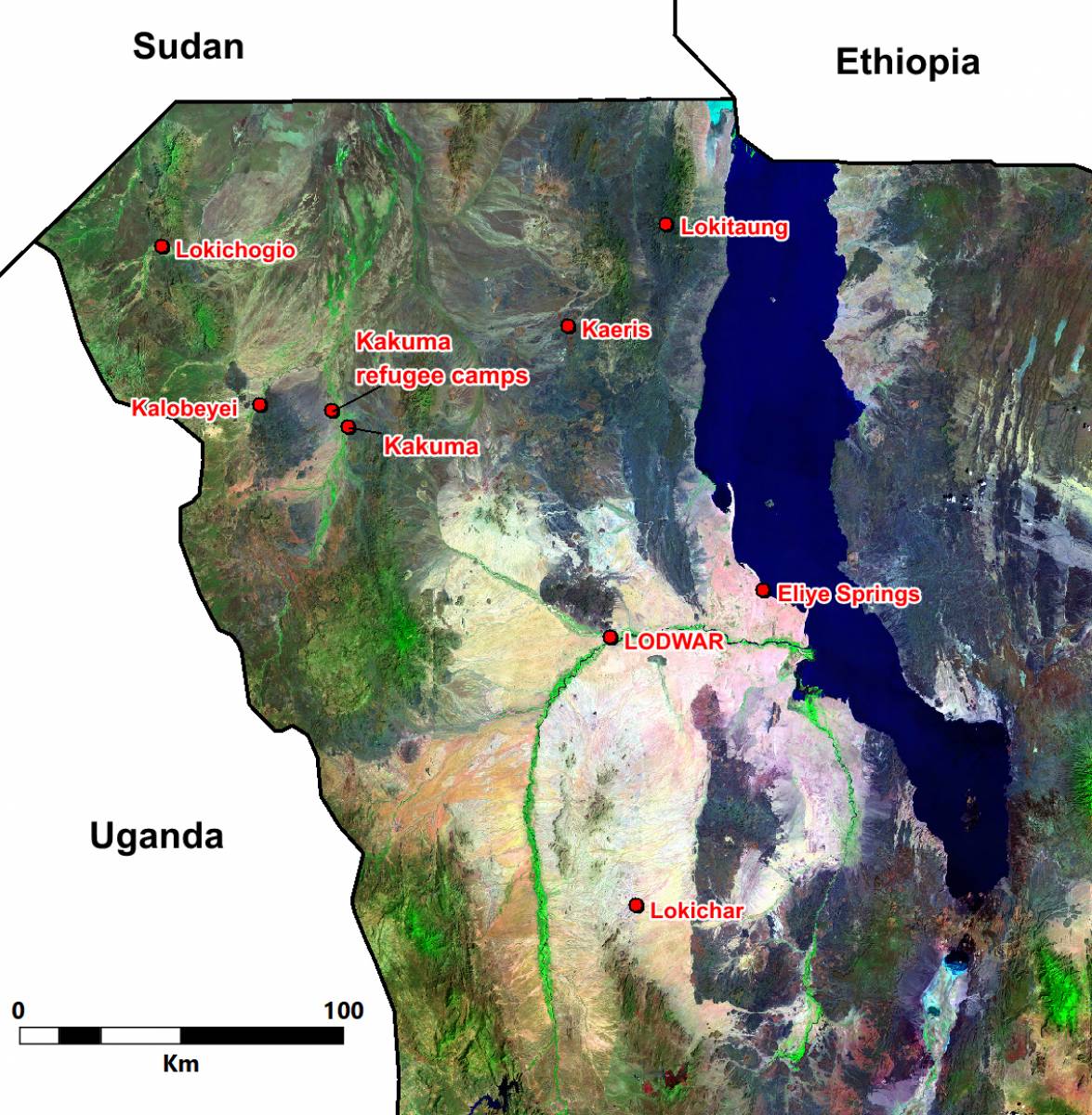
Kakuma is one of the biggest Refugee Camp in Africa. It is located in Turkana County, north of Kenya, near the borders of South Sudan, Uganda and Ethiopia and held by the UNHCR since 1992.
It serves refugees who have been forcibly displaced from their home countries due to war or persecution from South Sudan, Somalia, Ethiopia, Burundi, Democratic Republic of Congo, Eritrea, Uganda, and Rwanda. According to UNHCR statistics, the camp population held 107,698 refugees in January 2013.
The water supply situation of Kakuma refugee camp was dependent on 11 boreholes available in the camp. Only 7 were operating, the others were too saline to be used.

RTI RESPONSE IN 2013
A thorough survey using the WATEX™ system was conducted on the Tarash watershed, located upstream of the Kakuma Camp, which revealed the feasibility of extracting sufficient water to support a population of 200,000 people.
The Kakuma Refugee Camp is situated in the center of a broad geosyncline. The shallow basement is located between two distinct volcanic hills. Within this complex heterogeneous geological context, the Tarash watershed drains from south to north all surface water towards Kakuma.The Tarash riverbed itself is controlled by open fractures that are responsible of the up spring of salty hydrothermal water and should be avoided.

ESTIMATION OF THE GROUNDWATER POTENTIAL IN THE AREA
The boreholes, for safety reasons, must be concentrated only in the drilling corridor, along the Tarash River, along a 5 km wide stripe, reducing the recoverable groundwater flow of some 50 million m3/year, accessible by drilling boreholes.
Considering the daily water consumption of 20 l/day per person, which corresponds to 1.5 million m3/year for 200,000 refugees, the capacity of the Tarash watershed extends broadly over human consumption, leaving interesting possibilities for Kakuma camp extension and irrigated agriculture to supply food for the camp itself.
In the Kakuma area, the WATEX™ study revealed that most aquifers lie at a shallow to moderate depth, often less than 50 m. These aquifers are situated amongst inter-volcanic layers and within fractured geological formations initiated by the shallow granitic basement.
Drilling in the Kakuma area carries high risk due to the pervasive intrusive volcanic plugs, which are often not visible on the surface.
The WATEX™ system is also a tool to minimize risk in drilling operations. Hence, it was recommended to drill within the fracture corridor of the Tarash River, where conductive fractures converge with high potential areas. Drilling outside of the corridor carries a risk of difficult geology or low yields.

What is the situation in the Kakuma refugee camp early 2023 ?
An accurate match to RTI's analysis and estimation; as of December 31st, 2022, a total of 200,134 people, mostly South Sudanese refugees, reside in Kakuma refugee camps. The camps are managed by the Kenyan Department of Refugee Services (DRS) while the UNHCR coordinates all humanitarian actors operating in the camps.
The WATEX™ map generated at the time is still valid today, and used to drill new boreholes in Kakuma.
Learn more about our WATEX™ Groundwater Mapping projects by contacting us today!
